Chennai already learnt lot of lessons after 2015 floods.
Hope the Government Agencies/Departments like Police, Fire Service, Health, Revenue Administration, local bodies, etc are at high alert.
Also hope regular exercise of preventive measures on the on set of North East Monsoon were taken care of.
Hope Chennaiies will meet the challenges posed due to the expected cyclone.
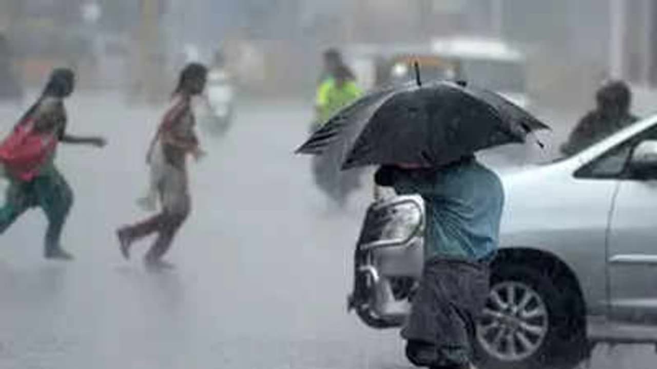
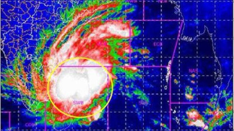
Chennai and parts of Tamil Nadu are likely to witness extremely heavy rainfall as Cyclone Nivar is expected to cross Tamil Nadu and Puducherry coasts, between Karaikal in Puducherry and Mamallapuram in Tamil Nadu, on the afternoon of November 25. The Indian Meteorological Department (IMD) in a bulletin stated that the depression over southwest and adjoining southeast Bay of Bengal is likely to intensify into a cyclonic storm over the next 24 hours.
The IMD has predicted widespread rainfall/thunderstorm activity over Tamil Nadu, Puducherry and Karaikal from November 24 to November 26. Tamil Nadu and Puducherry will witness isolated extremely heavy rainfall on November 24 and 25. On November 25, especially, Tamil Nadu is predicted to receive rainfall at most places, with heavy to very heavy rainfall at a few places and extremely heavy rainfall at isolated places.
Read more at:

 www.thenewsminute.com
PS: It is reported that the crossing point remains a guess.....
Hope the Government Agencies/Departments like Police, Fire Service, Health, Revenue Administration, local bodies, etc are at high alert.
Also hope regular exercise of preventive measures on the on set of North East Monsoon were taken care of.
Hope Chennaiies will meet the challenges posed due to the expected cyclone.
Cyclone Nivar: Chennai to witness extremely heavy rainfall, NDRF on standby
Tamil Nadu and Puducherry will witness isolated extremely heavy rainfall on November 24 and 25, the IMD has said.Chennai and parts of Tamil Nadu are likely to witness extremely heavy rainfall as Cyclone Nivar is expected to cross Tamil Nadu and Puducherry coasts, between Karaikal in Puducherry and Mamallapuram in Tamil Nadu, on the afternoon of November 25. The Indian Meteorological Department (IMD) in a bulletin stated that the depression over southwest and adjoining southeast Bay of Bengal is likely to intensify into a cyclonic storm over the next 24 hours.
The IMD has predicted widespread rainfall/thunderstorm activity over Tamil Nadu, Puducherry and Karaikal from November 24 to November 26. Tamil Nadu and Puducherry will witness isolated extremely heavy rainfall on November 24 and 25. On November 25, especially, Tamil Nadu is predicted to receive rainfall at most places, with heavy to very heavy rainfall at a few places and extremely heavy rainfall at isolated places.
Read more at:
Cyclone Nivar: Chennai to witness extremely heavy rainfall, NDRF on standby
Chennai and parts of Tamil Nadu are likely to witness extremely heavy rainfall as Cyclone Nivar is expected to cross Tamil Nadu and Puducherry coasts, between K
PS: It is reported that the crossing point remains a guess.....
Last edited: